Prairies as far as the eye can see

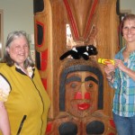
What a fantastic day! First we went to ‘Head Smashed in Buffalo Jump‘. This tourist attraction was set into the hills; you would have passed by other than the sign telling you about it. How did it get its name? See if you can find this out by using the internet. The jump is in the western territory of the Blackfoot Tribe of First Nation peoples. Make sure you check out the link for their website. Maybe you could research buffalo or the Blackfoot Tribe and write a post about them.

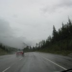
At breakfast we were told about another great attraction called Frank Slide. Only about 45 minutes from Head Smashed In. Well, maybe if the road was sealed, but we followed an unsealed road – totally gravel and all you could see on either side of the road was wheat fields and hay bales. Thne we saw a dam – it was across the Oldman River which was so important to the natives at the buffalo jump. But it has been a dry summer in Canada, so no water was going over the spillway. About an hour later we hit the sealed road and headed into Pincher Creek for some lunch – Subway again – Yes Miss W’s mum – they are nutritious meals.

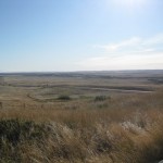
All along the sealed highways, you have little rest areas that include a sign giving the history of the area. This is a great way to let the other traffic through that is driving faster than we are. We set the cruise on either 80km or 90km per hour and then we have time to look at the scenery as well.

Following the Crowsnest Highway, you suddenly drive through all these boulders. The interpretive centre is just past these and after going in and watching the movie, you understand what happened here in 1903. Do  you know of any other rockslides that have caused so much damage and death? We have had many mine disasters like Mt Lyell near Queenstown in Tasmania but not rockslides.

We had planned to head to Drumheller to stay the night but that was still over three hours away, so we went back to Claresholm for a second night.

Did anyone see the episode of ‘Murdock Mysteries‘ where he has to go looking for his father – well that was where we were going – into the ‘badlands’. First we went to the Blackfoot Crossing where the treaty was signed between the Blackfoot Tribe and the government. Again the display was set into the hill and was shaped with tipis inside. Many of the displays had voices from the people themselves telling about their lives. One thing which amazed Miss W was that the tribe have their own school and included in the curriculum is drumming, native dancing as well as technology.

Onwards we went to Drumheller, to visit the Tyrrell Museum. What are they famous for? Dinosaurs! This was a fascinating place to visit. We could have stayed there for hours looking at all the dinosaurs and other animal skeletons on display. They actually send palaentologists all over the world including to Australia when dinosaur bones are found somewhere.

At the museum, it was recommended we divert off the main road and head to Warren via the 11 bridges in 6km. This sounded interesting, but when we arrived it looked like we had to go back the same way. Now Miss W does not like doing this so she headed off in an easterly direction. She knew from studying the map that we would eventually hit the main sealed road – the roads here have funny names like TWP 144 or FNTG 231 or RGE RD 123 – I wonder what all those letters stand for?

So here we are in Brooks for the night, ready to head to Dinosaur Provincial Park tomorrow – where they found some of those bones from the museum.

Leaving the mountains behind

Out of Kamloops today after staying at the Country View Motor Inn, which was great accommodation with helpful staff. Still trying to look for wild animals in the forests. We often see the Trans Canada Railway line beside us but haven’t seen the special Rocky Mountaineer yet. Would love to travel in that another time.

Followed the Shuswap Valley and turned off to visit the Roderick Haig Brown Provincial Park to check out the salmon. One little creek, there was one female flicking her tail to get rid of the stones where she was going to lay the eggs, and there were three males trying to court her. They kept chasing each other back and forward to the little area of rocks she had organized. After an hour, they were still trying to see who would fertilize the eggs.

Through Salmon Arm, following Trans Canada Highway 1 to Craigellachie, famous for ‘The last spike‘on the Canadian Railway line. Then we headed to higher country – up over Eagle Pass through Revelstoke and suddenly driving through tunnels on the road. Roger’s Pass, the highest point on the road deserved a picture and walk around . This part of the country reminded Miss W of Switzerland and I often heard her singing “The Lonely Goatherd” from Sound of Music.

Spent the night at Golden – most expensive night so far but I suppose we are on top of the world in the high Rocky Mountains.

Up early to head to Lake Louise and Banff. Seeing lots of signs to Kicking Horse Lodge or Kicking Horse activities. All the rivers up here are a funny greeny white colour. Wonder what causes that – I am used to either blue or brown water that has gone through the button grass back In Tasmania.

At Lake Louise, Miss W got some money from the ATM at the liquor store and we bought some more snacks to eat while driving. Headed up to Lake Louise itself, saw the fantastic Fairmont Lodge at the lake. Was too wet and windy to go on the gondola ride so we headed to Moraine Lake. Wonder why it was called that? There was a large pile of rocks at one end of the lake and lots of avalanche areas heading into the lake.

Back onto Highway 1 – noticing there are no native animals around but there are huge fences on either side of the road. Then we saw what looked like bridges going over the road and they also had high fences. Wonder what these are for?

Into Banff just to see the famous Banff Springs Hotel – so very impressive. This is what you always see on postcards about Banff. Even though there was no snow, the town was full of people.

At Canmore, decided to head off the main highway and followed a wildlife drive that was publicised in a pamphlet Miss W picked up. Finally we are going to see real animals in the wild. It was a gravel highway so we had to drive very slowly which suited us. More chances to see those animals. Notices were posted to look for elk, moose, bears, bighorn sheep, Rocky Mountain Sheep, coyotes. I looked right, Miss W left, then Miss W right and me left.

STOP!STOP! Go back – I was yelling so loudly.  Out of the corner of my eye I was sure I saw a  moose. We took a photo just to prove it, but it started to move away because a loud, noisy, fast car overtook us.

For the rest of the trip, we continued looking but the only other animals seen were …………cattle. Heading out of the mountains into the foothills so no chance now until we hit the east coast Canada /USA to see moose again.

Bypassed Calgary and headed south – staying at a Motel 6 in Claresholm, ready to visit Head Smashed In Buffalo Jump tomorrow.

Remember to leave a comment or write a post about something highlighted or of interest to you.

Heading for the mountains

Left Comox Valley in the rain – the same type of weather when we arrived – headed to the ferry terminal to catch another BC Ferry across to Powell River and drive up the Sunshine Coast.

Still not seen much in the way of animal life – how can you tell the difference between a female deer and a female elk? Saw one of them just chewing on the side of the road to the ferry.

Caught the 10.10 ferry across the Discovery Passage – no whales, no seals, no dolphins, NOTHING except flotsam and jetsam. Chatted with Mary from Campbell River and her grand-daughter Hanna who were on their way to visit relatives at Powell River.  Mary told me they had seen a fin whale and calf on the western side of Vancouver Island recently – they had not been seen there for about two hundred years since they were hunted to near extinction.

She also told me how the pulp and paper mill at CR had closed down recently and how it was affecting the community. A bit like our woodchip mill closing in Triabunna. As we came into the Powell River terminal, we could see the pulp mill working there. They used lots of derelict ships to cause a breakwater or holding area for the logs as they come to the mill.

Headed south – had three hours to fill in till the next ferry left Saltery Bay at 3.15. Many First Nation totem poles, middens, petroglyphs, fishing areas can be seen as you travel down the coast. Having learnt about the Inuit people, it was interesting to make comparisons.

Saw a sign about the Lang Bay Salmon Hatchery so pulled in there to check it out. Those poor salmon who didn’t make it were just rotting in the water – Miss W wouldn’t let me go down in the water to scavenge some meat. We watched some fish try for over half an hour before they got into the next section of the stream. There was a video playing on the side of the hatchery – showing bears catching the fish further up the stream – Miss W thought it was real live streaming – until I showed her it was only a film. She took a picture of a scat we found – not sure if they are rosehips, berries or salmon eggs? Can anyone tell us for sure?

Chatted with some people at the Saltery Bay terminal – they had been to Powell River to help with a healing type church. Thank goodness one of them had some balm as both Miss W and one of the other ladies got stung by wasps or bees. The wasp must have liked the colour of Miss W’s jacket. Another calm crossing to Earl’s Cove – now to make the decision – do we rush to catch the 6.45 ferry across to Vancouver or do we take it at a leisurely pace, stay the night at Gibsons and catch an early ferry tomorrow?

Up to catch the 8.25am ferry across to Horseshoe Bay then north on Highway 99 to Squamish and Whistler. Lots of driving through mountains and avalanche areas, roads with 20kph horseshoe bends, following creeks then rivers and crossing train lines. Then the scenery changes – hills and mountains are dry, not much cover, few trees – then suddenly a very lush area in a valley like at Hat Creek Ranch near Cache Creek.

Stopped there for a walk around a native interpretation centre of the ‘Bonaparte First Nation‘ tribe. Took lots of photos of what life was like for them before the early white settlers arrived and took over their land. Check them out on my flickr set.

Spending the night in Kamloops before heading to Banff tomorrow.

Please leave a comment or write a post about something highlighted or of interest to you.


Thank you, Comox Valley

Miss W and I have had a fantastic time on Vancouver Island, especially in the Comox Valley where we based ourselves for two days.

On our way through to Comox from Nanaimo, we pulled over to a rest area and checked out the facilities. To our amazement, the toilets were not the flushing kind but what we back in Australia call ‘long drops‘ or composting toilets. Had to take a picture of the sign on the door as Miss W’s brother works with Parks and Wildlife back in Tasmania.

We then went on some school visits to Jan Smith who runs the Huzzah blog and then to Jaki Braidwood who runs the Ripple Effect blog. Had a great time introducing the students to both my blog and also Miss W showed them the student challenge blog and her class blog back in Tasmania. When we got back that afternoon, I had 47 comments to moderate and leave a reply for. My little paws were very sore, so I had to rest in Jan’s bag at teatime. You should have heard the chatter about schools and teaching when Miss W, Jan, Jaki and Cathy from the Climb High blog got together for tea at Atlas Cafe. I must admit the wild sockeye burger Miss W had looked delicious as did the raspberry chocolate mousse (sorry Sue Waters – Miss W told me to mention it). I was so quiet, Miss W nearly forgot to get me out of the comfortable warm bag I was in.

The students had given us lots of suggestions of where to go today so off we went. First to the Airforce museum, then a long drive – we got lost again – to eventually find the Powell River ferry terminal where we needed a time table to know when to get there tomorrow. Finally back on the road we headed for Mount Washington. We were expecting to see lots of animals on the road but it was drizzly and foggy so they were probably hiding in the forests instead. Miss W had a long talk to the lady at the information office and was given some freebies to bring back to her students. As we drove back down the road, it looked like something drastic had happened to a ski chalet up on the hill. Maybe it was the 6.4 earthquake they had on the island a couple of weeks ago that caused the problem.

Onto the Inland Highway and up to Campbell River for a Subway lunch – these are good food as they have vegetables (lettuce), fruit (tomato), protein (meat) and carbohydrates (flatbread). Miss W’s mum worries that she doesn’t eat enough of the ‘good’ foods when she is away.We did stop further on at a farm fresh produce store and gathered some snacks including fruit and vege bars that are the equivalent of 2 pieces of fruit or vegetables.

Heading out of town, we hit a very unusual sign about the 50th parallel. What is that all about?

On the way back to Comox, we stopped off at Oyster Bay. Here was a beautiful wildlife refuge, mainly for sea birds and certain plants they are looking after. They have even made some bird nests out on poles in the bay.  A little stroll along the foreshore brought us to huge piles of driftwood. Not like the little ones we have in Tasmania that Bob, Miss W’s dad, likes to collect but these were huge, smooth logs. Some though looked like they had been eaten by animals that bore into them.

Through Courtenay and onto Cumberland where we visited a museum about the district which had once been full of coal miners. It is interesting to see that many of the same things happened in coal mines around the world back in the late 1800’s / early 1900’s. Miss W had a giggle when she read the notice about school teachers – we have exactly the same notice in our Pioneer School.

Back to the motel for tea, sleep and another day of travelling tomorrow.

If you want to leave a comment, feel free to mention something that happened to you or your family, similar to those things highlighted in this post.


We are on our way, Comox Valley!!

Firstly, a big thank you to the Grade 6/7 students and classes that gave Miss W a pen and notepad before she went on holidays. She has been using it to make notes ready to write these posts each day or couple of days.

Well, we left Newport, Oregon in fog. Not just a little fog, but thick ”can’t cut it with a knife” fog. This continued all the way up to a town called Seaside. It was here we chatted with a very friendly lady in the visitor’s centre. She agreed with Miss W about how the coast of Oregon and the Great Ocean Road in Victoria, Australia were very similar in scenery. She had been there and really enjoyed her stay. She gave us directions for the quickest route to Seattle and the suburb of Kirkland, which is on the eastern side of Lake Washington.

As we were driving up the coast , we often came across reference to Lewis and Clark. I wonder who they are? I also noticed that most houses along the coast were wooden, and often looked like shingles rather than long boards.

When we got to Astoria (near the border with Washington state), the map didn’t show very clearly that there were two bridges, so of course, Miss W thought we had gone over the one we needed to, and we ended up driving for about 10 minutes when she realised we were heading to Portland rather than Seattle. So we backtracked, went over the correct bridge and followed behind a very slow car to Olympia. One very impatient driver overtook eight cars in one go – luckily there was no traffic coming the other direction.

Olympia was time to fuel up the car, not knowing how long we would have to drive to find the motel in Kirkland. So off the freeway ramp, got petrol, followed a sign that said I5 which was the freeway. About 10 minutes later we were on a nice little road called Johnson Drive and it certainly wasn’t getting us near the freeway. Ask for help again, finally we hit the freeway.

Poor Miss W is not having good luck getting back on the freeway after fuelling up, but she is prepared to ask for help. In Kirkland, got to motel, wrote some emails to organize visit to Mrs Hembree and a couple of classes on Vancouver Island, which is in British Columbia province of Canada.

A day of rest required so no travelling in freeway traffic today. Instead we went into the suburb of Redmond and visited a chat room friend of Miss W. You can see her in the picture. Had a lovely lunch time cuppa with her and then back to check email and write some more blogging challenges and comments.

Miss W has still not heard from Alamo car rentals about having the car serviced. She sent them an email a few days ago mentioning she would be leaving USA for a few weeks and it was supposed to be serviced in about 1000 miles time.

So finally today. We headed off to the Alexander Graham Bell Elementary School to visit with Mrs Hembree in her library. Two classes came in and she read them a story about a Tasmanian Devil then the students asked Miss W some questions about Tasmania and other parts of Australia. After a quick tour of the school, which is under renovation at the moment, Miss W showed Mrs Hembree how to subscribe to RSS feeds. This makes it easier for teachers to read the posts on lots of blogs instead of going to each blog separately.

Mrs Hembree has contact with another Australian blogger named BB and her mum. If you want to check out BB’s blog, go to this link and Mrs Hembree has a blog for her readers at the school.

Our next stop was the USA / Canadian border at Blaine. There were police and customs officers who stopped my car and searched it fully, including the suitcase and backpack we had. They were amazed at someone driving all the way from California. Maybe they thought I was bringing drugs into the country. Lots of questions again about how much money I had with me and where I was going to stay.

Finally allowed to move on and head to the ferry terminal at Tsawwassen to catch the 3pm ferry. About 10 minutes out of the terminal, there was a sign saying the 3pm ferry was full and the next ferry 50% full. Luckily though, I paid for my ticket, got in the queue and drove onto the 3pm ferry.

It was a very pleasant trip, no large waves and Miss W and I stood outside looking for Orcas and dolphins, but no luck. It then started to rain so back into the car for the last half hour of the two hour trip.

Feel free to leave a comment or write a post about something highlighted, but we also want to know who Lewis and Clark are and why there is a trail you can follow of where they have been.

See the sea

Thank goodness, there was no tsunami last night so headed off again further north up the coast into Oregon. Miss W was expecting to have the car searched for food as we went into Oregon, but apparently it is only when you go into California. That is a bit like Tasmania – searched by dog when you come into the state but you can take out whatever you like. I suppose both California and Tasmania grow a lot of produce and they don’t want diseases from other foods coming into the state to cause problems. Miss W said there are problems at the moment about New Zealand selling their apples in Australia.

On route, we headed out to Cape Blanco, the western most point of Oregon. Luckily we got there in time to see the lighthouse, when suddenly a big fog bank came in off the Pacific Ocean. I nearly got lost finding my way back to the car.

The scenery up this coast is magnificent. Large rocks sticking out of the ocean a bit like the Twelve Apostles along the Great Ocean Road in Australia. Then you hit the Oregon Sand Dunes recreational parks where ATV are driven all over the huge dunes. Again that reminded me of my time when I was living near Strahan. My family loved rolling down the dunes there.

Then we went through Bandon Old Town and again memories of Stanley in Tasmania, where the old town is down on the foreshore while the new town is a little higher up the hill.

The high point of my day was visiting the sea lion cave – only problem there were no sea lions there. Poor Miss W was puffing and panting after the long walk down to the elevator and then the long walk back up to the gift shop. We took some photos down in the cave but one of the ladies in the shop mentioned the female sea lions had just given birth and they were all out feeding. Another couple who came up about ten minutes after us, said they saw one who came in, sat on the rock for a minute or so then went off again.

When looking at the map to plan today, Miss W noted there was a town called Newport in Oregon and we should stay there, cause we are also staying in Newport in Rhode Island later on the trip. So here we are in another Days Inn motel.

Miss W just got a tweet from Paul Bogush in Connecticut about his students joining the student blogging challenge. I think we might have to stay two days in Seattle so she can catch up on the welcome comments she sends to every student who joins the challenge.

Please leave a comment about something highlighted in this post. If you write a post about it on your blog, make sure you create a pingback or trackback, so I can come and read your post.

All about nature

We headed to the Redwoods National Forest today. Many people staying at the Days Inn at Ukiah (another plug there) were going south to a car rally but we preferred looking at nature. The place to be was around Eureka.

But on our way there, I noticed there were lots of casinos and smoke shops. In Australia, we have very few casinos – in fact in Tasmania there are only two – one in Hobart and one in Launceston. I wonder why there are so many of them up the west coast of USA?

Remember yesterday, I said we were going to drive through a tree. Well, look at me in that picture – up near the windshield wiper – Miss W drove the car and a lady from Germany took the photo for her. Travelling is a great way to make new friends.

We then got off Highway 101 and followed the old road through the ‘Avenue of the Giants”- these are the redwood trees found along a 400 mile stretch of northern California coastline. Another picture of me, you might need to zoom in to see me near the fern. In certain parts of the Tasmanian wilderness you can also see huge trees around the Styx Valley. How are the redwoods different to the gums?

When we stopped at a visitor centre, they mentioned that not all the redwoods are separate trees – many are clones of the parent tree. This is because of the funny knots you can see on the outside of the base of the tree. Do you know what these are called and how they form a clone of the tree? Yesterday I mentioned that cloud forming near the coastline – well that too is very important for the growth of the redwoods.

Further north, we visited the Humboldt wildlife reserve. Miss W noticed many of the birds to be seen here could also be found in the marshland near her school in Tasmania. I wonder if some of those birds fly here as part of their migration pattern? We saw an egret in the marshland and just as we were leaving I noted a funny looking dead snake out the window, so of course, we had to go back to get a picture of it. I wonder what it is called?

The other animal mentioned in all the brochures is elk. Going through the area north of Eureka called Orick there are designated areas where elk are often seen. Again we turned off Highway 101 and about 200 metres from the road, there was this magnificent elk heading straight to our car. Miss W stayed in the car, with the engine running, as male elk can charge at over 35 mph. Luckily this fellow just dawdled across the road in front of the car to the paddock or field of food on the other side.

Miss W likes to pull off the road before it gets dark – she doesn’t have good night vision like me. So we are staying in Crescent City but I have noticed all up the coastline and especially here, the mention of tsunamis. Apparently people died in Crescent City back in 2006 after a tsunami hit. She has looked in the guest directory and found the route we have to take if a tsunami warning goes off. Hopefully we make it through the night and have a chance to tell you our tales again tomorrow night from somewhere in Oregon.

Please leave a comment about something highlighted in the post.


Our first school visit today

After a fantastic night’s rest in the Days Inn motel in King City (we said we would promote it), Miss W and I headed off to San Francisco. We had left messages for Mr Miller in King City but didn’t get a reply in time so off to Kami Thordarsoni and her students in Santa Rita Elementary in Los Altos, south of San Francisco.

Miss W was much more careful today – we had no accidents with the car at all. One problem though, is we weren’t given a big USA road map with the car.  Last time Miss W was in USA she bought an AA Road Atlas but she didn’t bring it with her because it is 10 years old and would be out of date. So we are relying on gathering brochures that include maps of where we are going or checking out Google maps whenever we need to.

So today, we decided to head to Monterey Bay which is famous for its aquarium and whale watching in the Pacific Ocean.

***** Cooee, Australia, can you hear us?******

We decided to head cross country through Carmel Valley. But of course the maps didn’t have road numbers or anything on them. Luckily Miss W has a good sense of direction – she knew if we were heading north west we would hit the coast just south of Monterey Bay. Sometimes though the sun was coming through the left window which meant we were driving south – the roads were very windy reminding me of the roads near Queenstown in Tasmania. The hills were very dry and barren, but in the long valleys between we passed many wineries.

Suddenly we saw lots of clouds. This happened when we hit the coastline near Carmel. What would cause these clouds to form just on the coastline?

By the time we got out of the car near Monterey, we only had two hours to get to the school and with Miss W not knowing how bad the traffic would be (remember yesterday in LA), she decided to get on Highway 101 North until Highway 280 North. From there Ms Thordarsoni had given fantastic directions which we followed easily and we actually arrived 10 minutes early to the school.

What a great class they were!! Lots of questions about Australia – animals, population, temperatures, forests and deserts.  In fact, there and then I decided we need three new pages on this blog. One each for questions about Australia, Canada and USA. Students in Australia can answer the comments on the Australia page. Each comment will actually be a question left by another student who lives in a different country. The same will go for the other pages – Canadian students to answer questions left on their page and American students to answer those on the USA page.

The students also got to smell the tube of vegemite I brought with me. Some comments were about dogfood and fudge. Wonder what those two boys will think once they taste it!

We also visited another teacher and her class who have started blogging too. They also had some great questions about Australia and vegemite.

Now Miss W knew she needed to fill up with fuel (gas in USA), so after some directions by a parent who had arrived, off we went. Fuel was very cheap Miss W thought about $3.90 per gallon. Wonder how that compares to $1.40 per litre in Australia!

Now to head to San Francisco – more traffic jams – took 60 minutes to drive 7 miles – over the Golden Gate Bridge – see me in the photo. Out into the suburbs – well we missed the turnoff for Highway 1 up the coast. Miss W was in the middle lane where the sign had said to be, then suddenly we needed to be two lanes to the right and we just couldn’t get over in time for the turnoff, so we continued north on Highway 101 to Ukiah where we are staying the night.

Miss W needs to get better organized with snacks and food for when we are travelling. We have water and a couple of apricot and almond bars. She might have to do some shopping tomorrow before we head further north to drive through a tree – I’ll believe it when I see it.

If you want to comment on this post, what about answering some of the questions or write about things I have highlighted?